The Technology Behind Our Surveys: Capturing Accurate Point Clouds
For architects, the accuracy of a survey begins long before any modelling work starts. It depends on the quality of the data captured on site. At Archilink, we invest heavily in industry-leading LiDAR and drone technology to ensure that every project begins with precise, reliable information
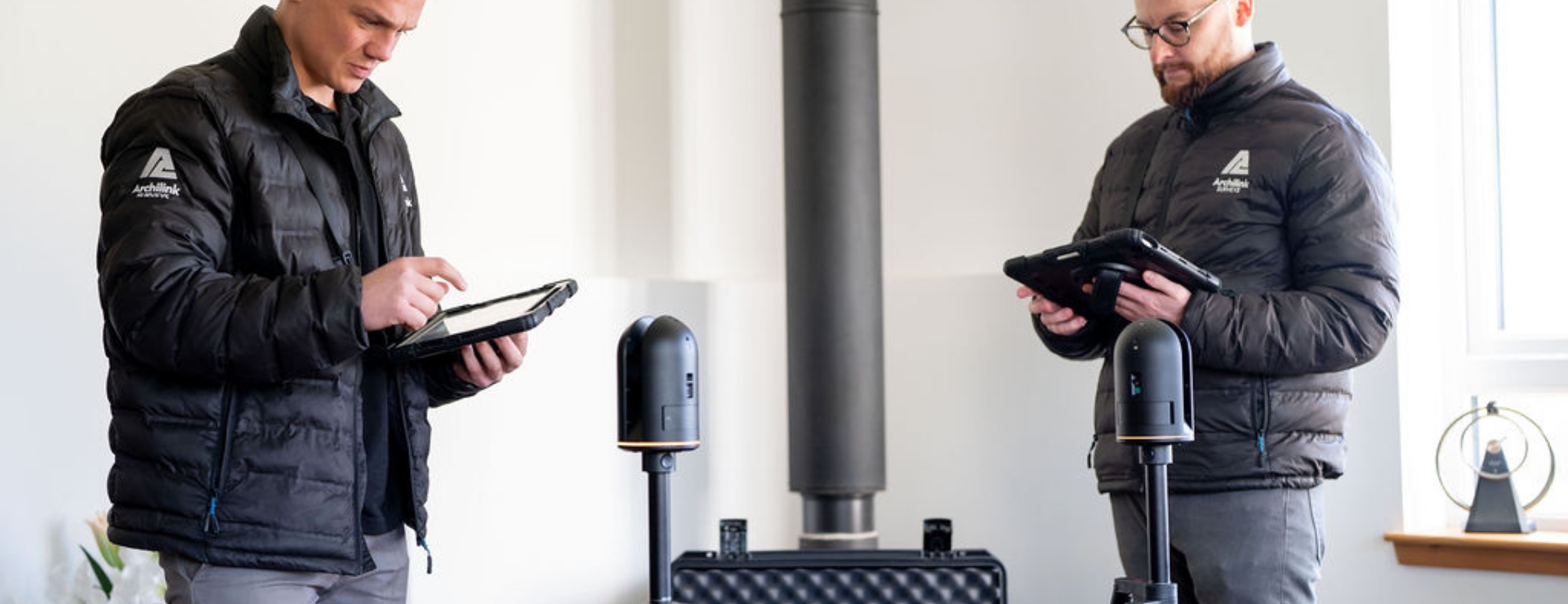
We use a range of LiDAR scanners, each selected for specific project requirements. Our core equipment includes the Leica BLK360 G1 and G2, Leica BLK2GO, and Leica RTC360. Each of these scanners serves a different purpose, allowing us to adapt our approach depending on the size, complexity, and environment of the building.
This is not a one-size-fits-all process. On many projects, we use a combination of these scanners to achieve the best possible results. For example, static scanners such as the RTC360 are ideal for high-accuracy, detailed captures, while handheld systems like the BLK2GO allow us to move quickly through complex or confined spaces. By combining multiple tools, we ensure both efficiency and precision across every survey.
We are highly loyal to Leica equipment, as we have found both the hardware and the workflow to be consistently reliable. The integration between devices and software allows our teams to work efficiently on site while maintaining a high level of accuracy in the data we collect.
For external areas and hard-to-reach locations, we also utilise drone technology. We primarily use DJI drones and operate a range of their models, enabling us to capture high-quality aerial imagery across different types of sites. This allows us to accurately document roofs, elevations, and surrounding environments that would otherwise be difficult or time-consuming to measure from the ground.
Once all point cloud data has been captured, whether from ground-based LiDAR or aerial drone surveys, our teams verify its accuracy before moving into the modelling stage. This ensures that the data you receive is both dependable and ready for design development.
By combining the right equipment with a flexible approach, we are able to take on a wide variety of projects across the UK and deliver consistently high-quality results. The strength of our surveys comes from using the right tools for each job, ensuring architects can move forward with confidence.
----
If you’re an architect with an upcoming project, we’d love to hear from you. We deliver reliable survey services across the entirety of the UK from our four location: Aberdeen, Glasgow, Manchester and London. Get in touch to find out how we can support your surveying needs.

POSTED BY
Alistair Lea