What to Expect When Archilink Comes to LiDAR Scan Your Home
At Archilink, we carry out LiDAR scans of more than 8 buildings every day from our Aberdeen, Glasgow, Manchester and London bases. Our team works across a wide area, helping homeowners, architects and design teams capture accurate building information quickly and efficiently. If you have a survey booked with us, here is a simple step-by-step guide to what you can expect on the day.
1. Our team arrives at your property
Survey appointments are usually scheduled for either 10am or 2pm. On the day, one or two surveyors will arrive at your property. When they arrive, all you really need to do is show them around so they can understand the layout and access points.
2. We unload and set up the equipment
The surveyors will bring the scanning equipment out of the van or truck and set up the LiDAR scanner. This is specialist equipment used to capture highly accurate measurements and detailed spatial data of your property.
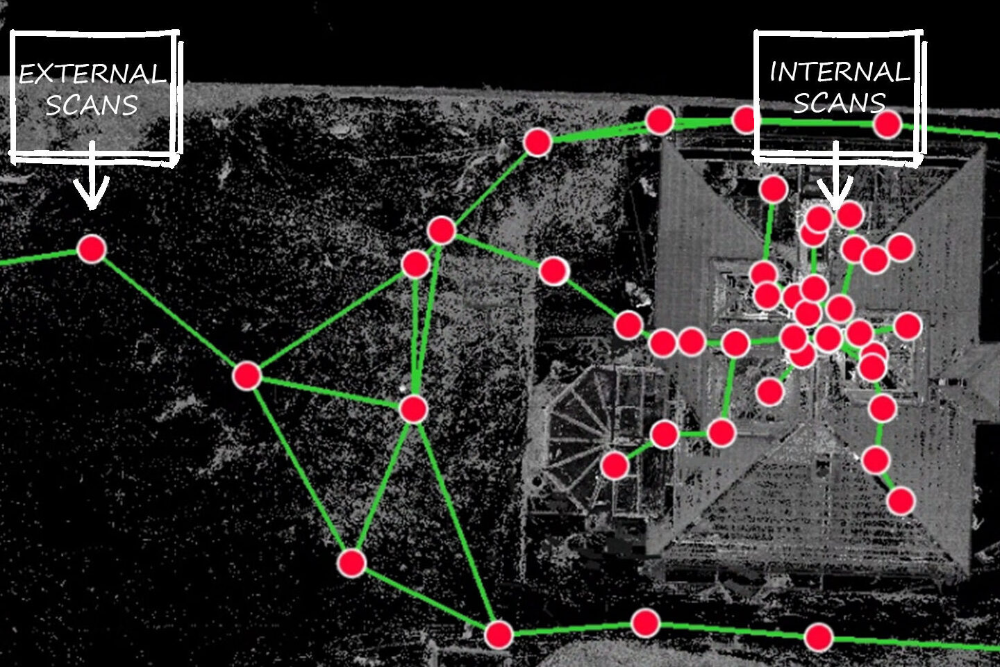
3. We scan every room inside the house
The team will need to scan every room within the property. To do this efficiently, it is very helpful if internal doors are propped open, cupboard doors are opened, and curtains are opened before the surveyors arrive. This helps us capture the necessary information more quickly and reduces the amount of time needed inside your home.
When scanning internally, the surveyor will usually position the scanner in the doorway and then in the centre of the room. This process is repeated throughout the property to make sure each area is fully captured.
4. We move outside to scan the exterior
Once the inside is complete, the surveyors will scan the outside of the building. This is typically done by moving the scanner in a loop around the house, positioning it roughly every 5 metres to capture the external elevations and surrounding context.
Before the team arrives, it is extremely helpful if there is a clear and uninterrupted route around the building. This allows the surveyors to work smoothly and safely.
5. We use a drone if needed
If there are areas that cannot be captured properly from ground level, the surveyors may use a drone to collect the remaining data, particularly for roofs or other hard-to-reach areas.
6. Back at the office, we process and model the data
Once the survey is complete, the internal, external and drone data are all stitched together back in the office. Our team then begins the modelling process, creating accurate survey information from the combined scan data.
By preparing a few simple things in advance, you can help the survey run as smoothly and efficiently as possible.
----
If you’re an architect with an upcoming project, we’d love to hear from you. We deliver reliable survey services across the entirety of the UK from our four location: Aberdeen, Glasgow, Manchester and London. Get in touch to find out how we can support your surveying needs.

POSTED BY
Shehan Heguragamage